REVIEW · UTRECHT
e-Scavenger hunt Utrecht: Explore the city at your own pace
Book on Viator →Operated by Qula · Bookable on Viator
One stroll through Utrecht, and you’ll start noticing the details. This e-scavenger hunt lets you explore at your own pace while answering city puzzles along a route built around the Dom Tower and Utrecht’s old corners. I love that it’s designed for real walking time, not rushing, and that the questions make you pay attention to specific places. The main catch: you need your own smartphone and some data, and the location pins can be a bit tricky in places.
If you’re the type who likes to “wander with a plan,” you’ll probably enjoy this. I also like that it’s easy to manage as a small group (up to 6) with an app that keeps things moving without constant stops. One drawback to keep in mind: some people found the app directions or hints less helpful than expected, so I’d keep a little extra patience in your pocket if the navigation feels off.
In This Review
- Key things to know before you start
- Utrecht’s e-scavenger hunt: your pace, your route
- Start at Domplein 20 and get walking fast
- What you’ll really do on the app
- Dom Tower: Utrecht’s symbol you’ll actually pay attention to
- Musical instruments and the joy of quirky stops
- Old church roots: 1039 to 1048 and still going strong
- Flower market in a busy pocket of Utrecht
- Oudegracht canals: the old canal that runs the center
- Utrecht University botanic garden near a former fort
- Railway Museum and the feeling of a transit landmark
- Neude: a swamp origin you can still feel in the layout
- Nicolaïkerk and Janskerk: two churches, different stories
- De Zeven Steegjes: working-class streets near the Oudegracht
- City hall with origins in 806
- Paushuize on the Pausdam and the rococo highlight on Agnietenstraat
- Sterrehof courtyard: a quiet national monument mood
- Timing advice: how to plan your 2 to 4 hours
- Price and value for a group of up to 6
- Who should book this e-scavenger hunt?
- My bottom line: should you book?
- FAQ
- FAQ
- How long does the e-scavenger hunt in Utrecht take?
- Where does the scavenger hunt start and end?
- What group size is it designed for?
- Is it available in English?
- Do I need a smartphone for this activity?
- Are there any access notes for this activity?
- What is the cancellation policy?
Key things to know before you start

- Flexible timing (2 to 4 hours) so you can slow down, stop for lunch, or take a longer look at canals and churches.
- Private for your group up to 6, which makes it work for friends of different ages and for small clubs.
- A mobile city trail in English with interactive questions you can tackle while you walk.
- A route built around Utrecht landmarks like Dom Tower, the flower market, Oudegracht canals, and major churches.
- Scoring and bonus points add a light bit of competition without turning it into a race.
- You supply the phone and data, since smartphone use isn’t included.
Utrecht’s e-scavenger hunt: your pace, your route

This is an e-scavenger hunt designed for walking around Utrecht’s center with prompts on your phone. Instead of following a strict guided script, you work through questions at the spots you reach—so you control the rhythm. That freedom matters in a compact city, where it’s easy to over-plan and end up tired.
The experience runs about 2 to 4 hours, which is perfect for an afternoon when you want to see plenty without feeling trapped. It’s also set up for small teams (up to 6), so you can split tasks or simply take turns reading the clues. And yes, it’s in English, which makes it straightforward for non-Dutch speakers.
I think the best part is how the game changes how you look at the city. You’re not just passing churches and streets—you’re stopping because a question points you there. That’s how you end up discovering the kinds of side details you’d otherwise walk right by.
You can also read our reviews of more tours and experiences in Utrecht.


Start at Domplein 20 and get walking fast
Your trail begins at Domplein 20, 3512 JD Utrecht, and it ends back at the same meeting point. That loop is handy: you don’t have to worry about transport back to where you started, and you can plan lunch in the middle rather than at the end.
The trail is available essentially all day (12:00 AM to 11:59 PM, Monday through Sunday). Practically speaking, you’ll still want daylight if you can—Utrecht looks great in natural light, especially around canals and church stonework.
One practical point: because you’re relying on a phone, start with a charged battery and be ready to spend time near busy sidewalks. Also remember the listing doesn’t include smartphone and data, so bring both (or a working alternative like reliable Wi‑Fi you can access during the walk).
What you’ll really do on the app
The experience is built around a mobile ticket and an interactive city trail. You’ll answer questions linked to stops around the center and use the app to keep track as you move. The app setup is meant to feel simple—review comments describe it as well designed and easy to navigate.
A few small elements can make it more fun:
- There are score elements in the app, including a score system.
- People also mention bonus points when you reach certain locations.
If you’re traveling with friends, that scoring can turn a normal walk into something playful—like mini-challenges timed by your own pace, not by a guide’s schedule.
Dom Tower: Utrecht’s symbol you’ll actually pay attention to
Your route kicks off at Dom Tower, the most obvious starting point in Utrecht for a reason. It’s the tallest church tower in the Netherlands at 112.5 metres, and it’s treated as Utrecht’s symbol.
What I like about leading with this is that you can build context before the rest of the walk. Even if you only glance up for a minute, it gives the city a focal point. The Dom Tower also has real depth: construction began in 1039, and it was inaugurated on 1 May 1048.
You’ll likely spend time near the tower’s surrounding area because the trail clues draw you in. That’s a smart way to avoid the common Utrecht mistake—seeing the landmark from a distance and never really looking.
Musical instruments and the joy of quirky stops
Next up is a stop featuring a self-playing musical instrument collection, ranging from music boxes and clocks to pianolas and barrel organs. This is the kind of place that breaks the rhythm of churches and streets with something fun and unusual.
Why it works in a scavenger hunt: the route isn’t only built around the obvious postcard stops. You get a contrast, and that keeps the whole outing from feeling like a checklist.
Practical tip: if you’re someone who rushes museums, slow down here. Even a short look can change how you view “quiet” museum spaces—some collections feel more alive when you’re not just reading labels at top speed.



Old church roots: 1039 to 1048 and still going strong
As the trail continues, you hit one of the city’s oldest churches, tied to the same long Dom timeline. The key fact you’re meant to notice is the construction span: it began in 1039, and the church was inaugurated on 1 May 1048.
This is where the scavenger hunt format helps. Without the prompts, it’s easy to treat old buildings as scenery. With the game, you pause long enough to connect dates to stone—so you start to feel the age instead of just seeing it.
If you’re the type who likes history but hates long lectures, this style is a good fit: the information is compact, and you get to keep moving.
Flower market in a busy pocket of Utrecht

Then the route turns toward the flower market—described as colourful and comfortably busy, with a huge array of cut flowers and plants. This is an easy stop to love because it’s sensory and immediate.
For your planning, treat this as your mid-walk reset. Even if you don’t buy anything, it’s a solid place to:
- stretch your legs,
- take photos,
- and get a quick burst of local street-life energy.
It’s also a good reminder that Utrecht isn’t only churches and canals. The city’s everyday details show up fast when you build the walk around real places, not just monuments.
Oudegracht canals: the old canal that runs the center

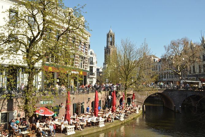
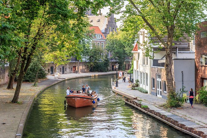
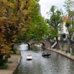
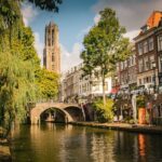
One of the most Instagram-able parts of Utrecht is also one of the most lived-in: the Oudegracht canal. It runs through the center and is famous for a reason—along it you’ll find canalside restaurants and a constant flow of people.
A scavenger hunt makes this section especially fun because you’ll be scanning both the built environment and the street-level life. Instead of just walking past canal houses, you’re more likely to pause and look at how the canal shapes the whole feel of the neighborhood.
If you want to take a break, this is where I’d do it. You can grab something to drink, watch the canal traffic, and still have plenty of time to finish the route.
Utrecht University botanic garden near a former fort
The trail continues to a botanic garden on the Utrecht University campus, located around a former fort. The area is part of the Holland Water Defence, which is a nice blend of nature and engineering history.
This stop is a good “breather” after busier streets. Even if your interest in botany is light, the location itself makes it worth the time. It’s the kind of place where the question format can nudge you to look for how the landscape relates to the city’s defensive past.
For photos and calm walking, aim to slow your pace here. You don’t want to sprint through a garden stop just to keep the team score perfect.
Railway Museum and the feeling of a transit landmark
Another highlight on the route is the Railway Museum area, described as part of the most exciting train station experience in the Netherlands. The point is that it isn’t only a museum you visit—it’s tied to a dramatic, memorable station setting.
Why this matters on a scavenger hunt: it gives you a break from churches and canals. It also adds a different “Utrecht angle,” showing how transport and industry shaped the city, not just its medieval center.
If you’re into trains, this section will likely feel like your group’s reward stop. If trains aren’t your thing, the station atmosphere still gives you a strong visual contrast.
Neude: a swamp origin you can still feel in the layout
The trail includes Neude, a central square with an etymology worth knowing. The name comes from node, meaning swamp, and the square used to be a lot lower than it is now.
This is the kind of clue that makes you start noticing Utrecht as a city built on adaptation. You’ll start thinking about how water shaped development—an idea that ties nicely back into the canal and the Holland Water Defence connection.
As you walk, look at the difference between streets and squares. It can help you understand Utrecht not as a single era, but as layers of change.
Nicolaïkerk and Janskerk: two churches, different stories
You’ll reach both Nicolaïkerk (also known as Nicolaaskerk) and Janskerk.
Nicolaïkerk is located at Nicolaaskerkhof 8. Even if you’re not going in, just being able to pinpoint it helps anchor the church to a specific place in your mental map of Utrecht.
Then comes Janskerk on Janskerkhof, founded shortly after 1040 by Bishop Bernold and dedicated to John the Baptist. That dedication detail gives you something concrete to hold onto instead of vague “old church” thoughts.
If you’re touring with friends who aren’t huge church people, this scavenger hunt format is still a good equalizer. It turns the buildings into clue-and-answer stops, not timed visits.
De Zeven Steegjes: working-class streets near the Oudegracht
Next, the trail shifts toward De Zeven Steegjes, described as one of the last working-class neighborhoods in the center. These are characteristic workers’ houses near the Oudegracht.
This section adds texture to your Utrecht story. You’re not only looking at official landmarks; you’re seeing the kind of streets where daily life happened, and where the city’s social geography shows up in the buildings themselves.
I like this part because it tends to make you slow down. Smaller streets encourage quieter walking, and your brain starts to notice how neighborhoods connect to the canal.
City hall with origins in 806
The route includes the City Hall of Utrecht, which is more than just a pretty civic building. The oldest parts date back to 806, and after five centuries, it looks more like the city hall you recognize today.
This is another place where the hunt format helps. A “quick photo” view of city hall is fine, but a clue-driven stop makes you look longer, and longer looks make the age register.
If you like architecture, take a bit of time here to study shapes and details. If you don’t, at least read the core idea about its beginnings and you’ll get something from the stop.
Paushuize on the Pausdam and the rococo highlight on Agnietenstraat
Two more stops keep the pace interesting while covering different periods.
First is Paushuize, a monumental building built at the beginning of the sixteenth century and located on the Pausdam. It’s a straightforward “big era, big building” stop that fits well into the hunt rhythm.
Then you reach the building on Agnietenstraat, completed in 1761. It was originally built as a boarding school for orphaned boys, and the building is noted for being one of the highlights of rococo in the Netherlands.
This is one of those stops where you’ll likely want to pause for photos. Even if you’re not an art-history person, rococo details can be visually rewarding when you’re not rushing.
Sterrehof courtyard: a quiet national monument mood
Finally, the route ends at the Sterrehof, a courtyard with an atmospheric feel and valued as a national monument.
Courtyards can be easy to miss in cities, especially if you’re only moving along main streets. It’s a fitting ending because it gives you a calmer “finish frame” before you return to Domplein 20.
Timing advice: how to plan your 2 to 4 hours
Because the trail is self-paced, I’d plan it like this:
- Budget 2.5 to 3 hours if you’re walking steadily and stopping briefly at each location.
- Budget 3.5 to 4 hours if you like to linger at the flower market, canals, and one or two church areas.
One helpful thing from real experiences: people have taken their time, deviated a bit, stopped for lunch and drinks, and still finished with a long walk (around 10 km). That tells me this trail can easily become a half-day wandering plan, not a tight 90-minute activity.
Price and value for a group of up to 6
The price is $37.21 per group (up to 6). That’s the key value driver: it’s group pricing, not per person, and that can make it surprisingly cost-friendly.
To do the math yourself:
- If you play with 6 people, you’re effectively around $6.20 per person for a structured walking adventure with puzzles and multiple major sights.
- If you play with fewer people, the cost per person rises, but you still get a lot of route content for the money.
What makes it feel like good value isn’t just the landmarks. It’s the way the trail turns sightseeing into an active experience—so you’re not paying simply for entry tickets, but for the “reason to stop” at the places.
Who should book this e-scavenger hunt?
This works best if you want:
- a fun, educational walking activity without following a fixed tour schedule,
- a route through Utrecht’s center sights that you might otherwise skip or only pass by,
- and a format that’s fine for mixed ages (it’s been described as suitable for all ages).
It may be less ideal if you strongly prefer:
- perfectly accurate GPS pin locations every time,
- lots of deep explanations baked into the answers.
Some people felt the answers weren’t explained in great detail and that navigation hints could be imperfect. If you want thorough background on every clue, you might plan to use your own reading after the walk.
My bottom line: should you book?
Yes, if you want a light-game way to see Utrecht’s big highlights and a few quieter corners. The pacing flexibility, interactive questions, and the mix of Dom Tower, canals, markets, gardens, and church stops make this a strong way to spend a morning or afternoon.
I’d book it confidently if you’re traveling with friends, want a self-guided feel, and are okay with the occasional bit of phone navigation awkwardness. Bring patience, charge your phone, and wear shoes you don’t mind getting a little dirty—Utrecht rewards slow walking.
FAQ
FAQ
How long does the e-scavenger hunt in Utrecht take?
The experience takes about 2 to 4 hours.
Where does the scavenger hunt start and end?
It starts at Domplein 20, 3512 JD Utrecht, Netherlands and ends back at the same meeting point.
What group size is it designed for?
It’s listed as a private activity for your group only, with a maximum team size of up to 6 people.
Is it available in English?
Yes, the experience is offered in English.
Do I need a smartphone for this activity?
Yes. Smartphone & Data are not included, so you’ll need your own phone and data access.
Are there any access notes for this activity?
Service animals are allowed, it’s near public transportation, and it’s described as user-friendly for hearing impaired.
What is the cancellation policy?
You can cancel for a full refund if you cancel at least 24 hours in advance. If you cancel less than 24 hours before the start time, the amount you paid won’t be refunded.